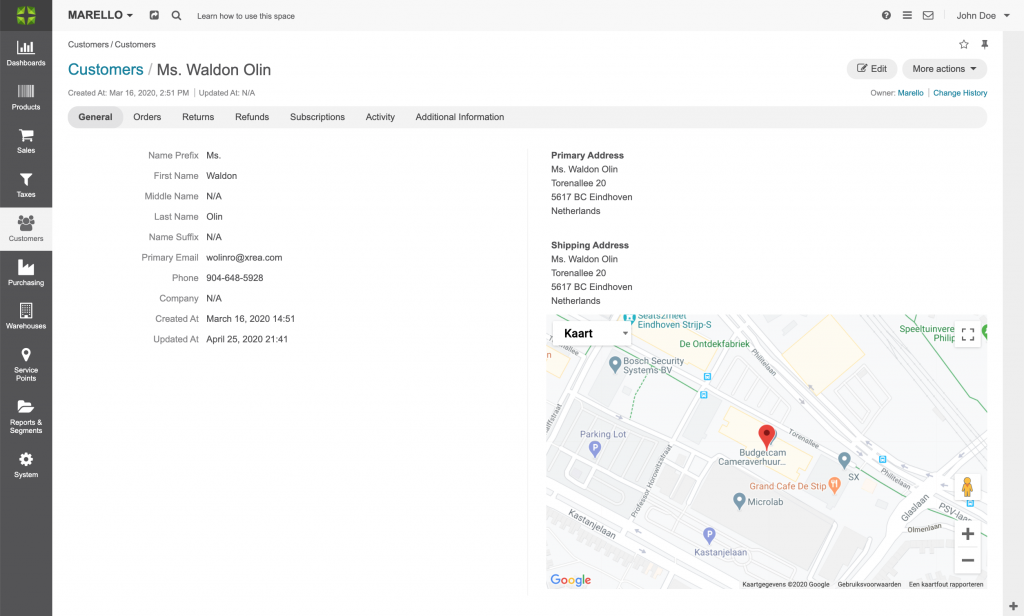
Marello uses services from Google to show maps on, for example, the customer view page. It also uses these services to calculate distances between Warehouses and the shipping address to determine the best shipping route.

Configuration
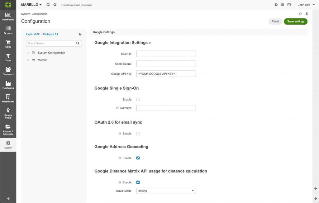
To be able to use Google services you need to configure the Google Settings in Marello.
Navigate to: System -> Configuration -> Integrations -> Google Settings

Google Integration Settings
To allow Marello to integrate with Google you need to enter the following information:
- Client Id: The Client ID generated in the Google API console.
- Client Secret: the Client Secret generated in the Google API console.
- Google API Key: The Google API key is a unique identifier that is used to authenticate requests from Marello to Google.
Follow Get API Key for instructions on how to create your unique Google API key.
Once the information is added to the Marello Google Integration Settings and saved, a map will be shown on the Customer view Page. The map shown is based on the Customer’s Primary Address.
Distance Calculation
Marello uses Google services to calculate distances between warehouses and shipping addresses to calculate the optimal fulfillment route.
Google Address Geocoding
Geocoding is the process of converting addresses (like a street address) into geographic coordinates (latitude and longitude).
Google Distance Matrix API
The Distance Matrix API is a service that provides travel distance and time for a matrix of origins and destinations. The API returns information based on the recommended route between start and endpoints.
Warehouse Fulfillment Allocation
The WFA (Warehouse Fulfillment Allocation) rules use distance as one of the parameters to decide to what Warehouse an order (or part of an order) is assigned.
To be able to calculate the distance by a WFA rule both the Google Address Geocoding and Google Distance Matrix API need to be enabled.

